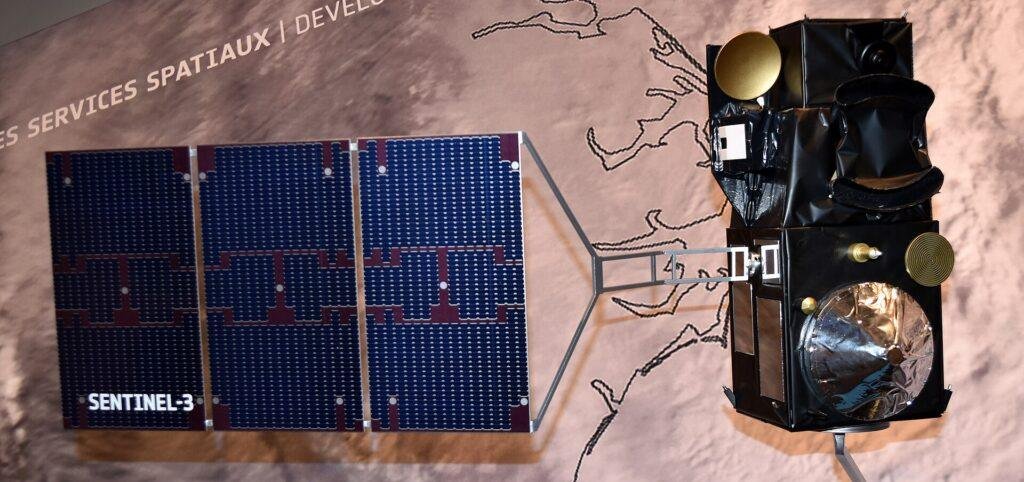
The Copernicus Sentinel-3C satellite has sent back its first images and measurements of Earth two weeks after launch. In an Oct. 8 announcement, the European Space Agency (ESA) called this a major milestone and said it confirms the satellite is working well. The data come from two of its key instruments: the Ocean and Land Colour Instrument (OLCI) and the Synthetic Aperture Radar Altimeter (SRAL).
OLCI took the first images on Sept. 29 and 30. They show Italy, part of the Canadian Arctic and the Caribbean. The altimeter measured sea-surface height and the height of the Greenland ice sheet. The spacecraft is the third in the Sentinel-3 series. ESA is still commissioning it, a job the agency says will take another five months. After that, EUMETSAT takes over routine operations.
What Sentinel-3C Captured First
The first image ESA released, captured by OLCI on Sept. 30, is a natural-color view of Italy that reaches from southern Germany in the north to Sicily and the southern Mediterranean. ESA highlights the Po Valley, which it calls Italy’s agricultural heartland, and the snow-capped Alps just to its north.
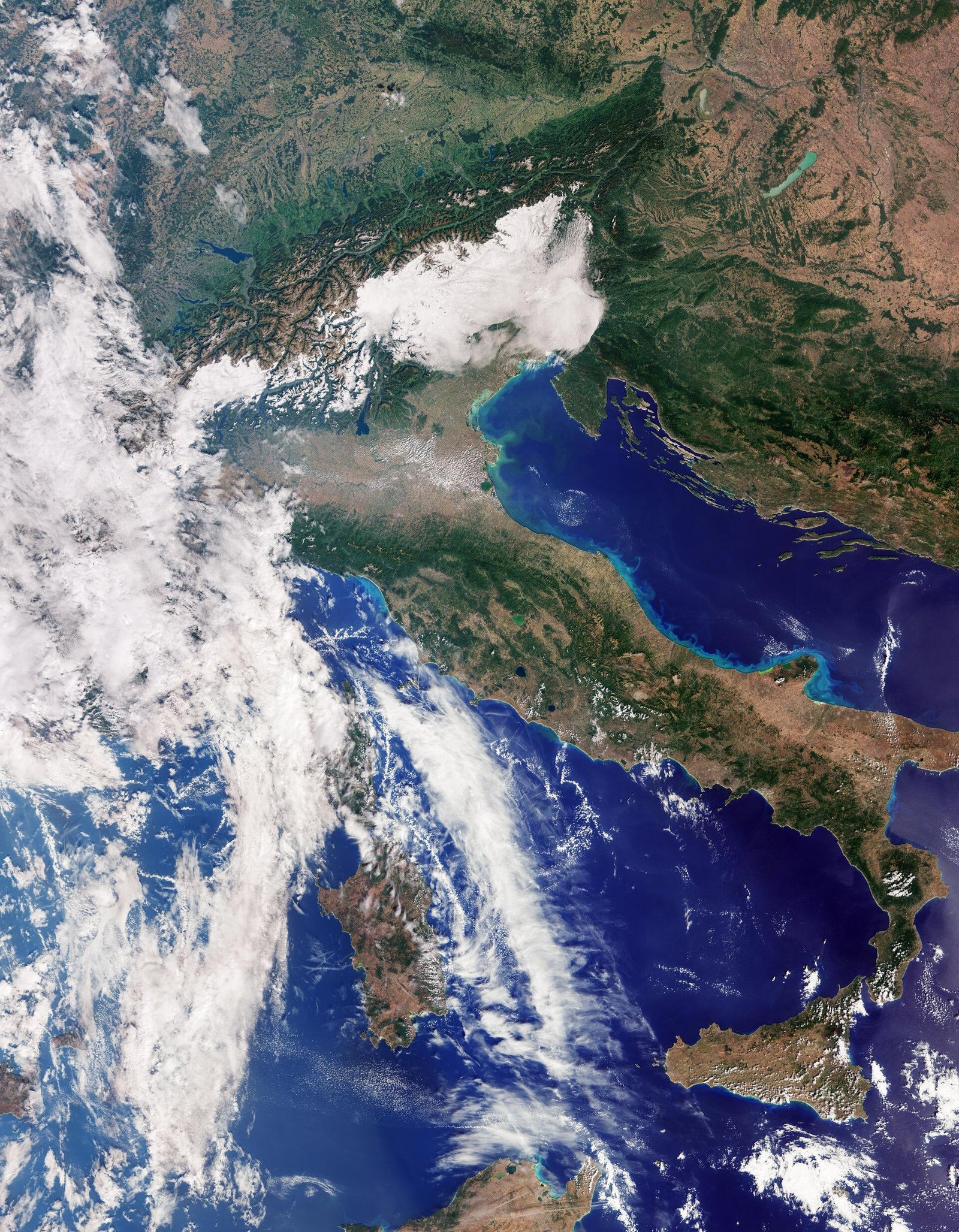
The agency also points to lighter blue water along Italy’s eastern coastline. It says these brighter tones are likely caused by sediment that rivers carry into the sea and that is then moved along the coast. To the west, Sardinia and Sicily are clearly visible, but cloud covers most of Corsica.
OLCI took a second image the same day. It shows part of the Canadian Arctic Archipelago, west of Greenland, with snow- and ice-covered islands, rugged coastlines and deep fjords. ESA notes that sea ice is at its minimum at this time of year, although some broken-up floes can be seen on the dark open water.
The third image was taken on Sept. 29 and covers part of the Caribbean. Cuba is to the south and the Bahamas are toward the top of the image. Shallow water around the islands appears turquoise against the darker, deeper water of the open sea.
EU Space says Sentinel-3C carries the same payload as its predecessors. ESA’s Sentinel-3 instruments page, which describes the series, says OLCI has 21 spectral bands between 400 and 1,020 nanometers, a spatial resolution of 300 meters for all measurements and a swath 1,270 km wide. The instrument builds on Envisat’s Medium Resolution Imaging Spectrometer. Its bands are tuned to measure ocean color and vegetation and to correct for the atmosphere.
Altimeter Checks Over the Sea and Greenland
The altimeter’s early results were checked against existing data. ESA compared a map of sea-surface height over the Atlantic Ocean and the Mediterranean Sea with the Copernicus Marine Service multimission sea-level anomaly. It says the new data show the altimeter is performing well and its readings are comparable to current measurements.
Over Greenland, ESA says all of the ice-sheet height tracks measured between Sept. 30 and Oct. 4 closely matched the reference digital elevation model. ESA’s animation of these measurements is dated Oct. 8. The agency says it was made from the new satellite’s data with the help of AI.
The altimeter works in two radar frequency bands, Ku and C, and draws on technology from the CryoSat and Jason missions. After synthetic aperture radar (SAR) processing, it measures at a resolution of about 300 meters along the satellite’s track. ESA’s instruments page, which describes the Sentinel-3 series rather than Sentinel-3C alone, says in the future tense that its SAR altimeter “will be the first satellite altimeter to provide 100% coverage over all of Earth’s surfaces in SAR mode.” A microwave radiometer provides the atmospheric corrections the altimeter needs.
After commissioning, ESA says, the altimeter will help track changes in sea-surface height around the world. This will add to long-term records from missions such as Copernicus Sentinel-6 and Jason. It will also measure changes in the height of lakes, rivers, sea ice and land ice, complementing the upcoming Copernicus CRISTAL mission.
ESA says high-precision satellite altimetry has shown that global sea level has risen by an average of 3.64 mm per year since 1999, and that the rise is speeding up. The agency adds that ice loss from the Greenland and Antarctic ice sheets is a major contributor to sea-level rise.
From Vega-C Launch to Commissioning
Sentinel-3C was launched together with ESA’s Fluorescence Explorer (FLEX) satellite, an Earth Explorer mission, on Vega-C flight VV30, from Europe’s Spaceport in French Guiana. ESA says the rocket lifted off at 22:21 local time on Sept. 14. That was 01:21 Coordinated Universal Time (UTC), or 03:21 Central European Summer Time (CEST), on Sept. 15, the launch slot the European Commission announced before launch.
A launch adapter called Vespa let the two satellites be stacked inside the fairing. Sentinel-3C sat on top and was released into orbit first, and FLEX followed about an hour later. ESA’s European Space Operations Centre in Germany then received the first signal from each satellite.
Before the launch, the Commission said Avio’s Vega-C would place the satellite in a Sun-synchronous orbit around 820 km above Earth. The Commission puts the satellite’s mass at about 1,143 kg. ESA designed and developed it on behalf of the Commission, and Thales Alenia Space was prime contractor.
At launch, Simonetta Cheli, ESA’s Director of Earth Observation Programmes, said: “Sentinel-3C is the third satellite in the Sentinel-3 series, systematically measuring Earth’s oceans, land, ice and atmosphere to support Europe’s Copernicus Services.”
Once commissioning ends, ESA and EUMETSAT share the mission. EUMETSAT handles routine satellite operations and delivers marine and atmospheric data, while ESA delivers land, cryosphere, inland water and offline atmospheric products.
ESA has not yet released first results from Sentinel-3C’s Sea and Land Surface Temperature Radiometer (SLSTR). It says they are coming soon. According to ESA, SLSTR measures sea- and land-surface temperatures and has two thermal infrared channels designed to detect active fires.
Taking Over From Sentinel-3A
Sentinel-3A was launched in 2016 and Sentinel-3B in 2018. The Commission’s EU Space service says both have outlived their design lifetimes but are still operating. It says Sentinel-3C will first work alongside them and, after in-orbit testing and commissioning, take over Sentinel-3A’s primary operational role, maintaining the mission’s two-satellite configuration.
The changeover also involves FLEX. ESA says FLEX will first orbit in tandem with Sentinel-3A, and Sentinel-3C will later be moved to take Sentinel-3A’s place in that formation. Flying together lets FLEX combine its readings of the faint fluorescence that plants give off with Sentinel-3 observations taken at almost the same time.
Over the oceans, Sentinel-3, which ESA calls the Copernicus workhorse, measures the temperature, color and height of the sea surface and the thickness of sea ice. Over land, it monitors drought, wildfires and vegetation health and measures the height of rivers, lakes and polar ice sheets. ESA adds that the mission provides near-real-time data for weather forecasting.
EU Space says Sentinel-3D is expected to follow in 2029, and that the two new satellites are meant to keep Sentinel-3 observations going into the 2030s.
Separately, EU Space says that since Aug. 3, 2026, data from selected passes of the existing Sentinel-3A and Sentinel-3B satellites over southern and central Europe have reached users in about 90 minutes. Standard near-real-time products take up to three hours.
Among other recent space launches, The Aviation Diary has covered the NROL-97 Falcon Heavy mission for the National Reconnaissance Office.
FAQ: Sentinel-3C First Images
What is FLEX, the satellite launched with Sentinel-3C?
At launch, ESA’s Simonetta Cheli said: “Developed within ESA’s FutureEO programme, FLEX is a research mission that will advance our understanding of plant health and the role of photosynthesis in the carbon and water cycles.”
Is Copernicus data free?
The European Commission, which owns, manages and funds Copernicus, says the programme provides free data to support citizens, businesses, researchers and public authorities. It adds that Sentinel-3C will ensure continuity of Sentinel-3’s services for thousands of users worldwide.
What are Sentinel-3 data used for day to day?
According to the Commission, the data help monitor wildfires and support the analysis of extreme weather such as heatwaves. During intense heat, it says, land surface temperature readings help authorities assess the impact on communities, agriculture and ecosystems.
Looking Ahead
The next step ESA has announced is the release of first observations from the temperature radiometer. Commissioning has not been given an exact end date beyond ESA’s estimate of five months. After that, EUMETSAT will take over routine operations and, according to EU Space, Sentinel-3C will take over Sentinel-3A’s primary role. ESA says the satellite will later replace Sentinel-3A in its tandem formation with FLEX. EU Space says Sentinel-3D is expected to follow in 2029.
Sources
- European Space Agency — Sentinel-3C returns its first views of Earth, Oct. 8, 2026
- European Space Agency — Greenland ice sheet elevation from Sentinel-3C (video), Oct. 8, 2026
- European Space Agency — FLEX and Sentinel-3C launched, Sept. 15, 2026
- European Space Agency — Sentinel-3 Instruments
- European Commission (DG DEFIS) — Countdown to Launch: Copernicus Sentinel-3C Takes Flight on 14 September, July 30, 2026
- EU Space (European Commission) — OBSERVER: New satellite to carry the Copernicus Sentinel-3 record into the next decade, Aug. 28, 2026